Join the OMRR Club to receive a race discount!
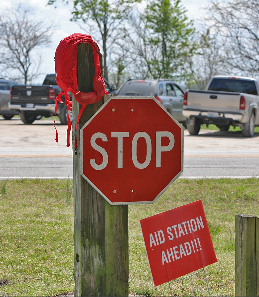
AID STATIONS
There are manned aid stations along the course to fulfill your fueling needs! All aid stations will have water, electrolyte drink, soda, gels, fruit and a port-a-potty (there is no port-a-potty at mile 2.5).
50-Mile
Mile 2.5 (no port-a-potty)
Mile 5
Mile 7.5
Mile 10
Mile 13
Mile 15.5
Mile 20
Mile 25 (drop bags)
*Must check-in at each station. If running through, shout your bib number and receive verbal confirmation of check-in.
50K
Mile 2.5 (no port-a-potty)
Mile 5
Mile 7.5
Mile 10
Mile 13
Mile 15.5 (drop bags)
*Must check-in at each station. If running through, shout your bib number and receive verbal confirmation of check-in.
26.2
Mile 2.5 (no port-a-potty)
Mile 5
Mile 7.5
Mile 10
Mile 13
13.1 & 8K
Half Marathon
Mile 2.5 (no port-a-potty)
Mile 5
8K
Mile 2.5 (no port-a-potty)
Aid Station Rules
- The Aid Station Captain is in charge of the aid station.
- Crews are allowed into the aid station only when their runner is present.
- The Frisco Highline Trail is a park - alcohol is not allowed at any point on the trail.
- Children are allowed at an aid station only under the direct supervision of an adult.
- Food, drink, medical supplies, etc at the aid stations are provided for participants.
- Excessive noise, raucousness, and partying are not part of an effective aid station. Please save your celebrations for when your runner crosses the finish line!
- Crew may give runners aid at the aid stations only, do not enter the trail between aid stations. Runners or their crew should not stash aid along the course.
- Ultra runners (50-Mile & 50K) must check in at each aid station. If running through, shout your bib number and receive verbal confirmation of check-in.
Aid Station Directions
The following directions are written as if going to the aid stations in the order they are listed. To go directly to an aid station, please use the GPS coordinates provided.
IMPORTANT: The Frisco Railroad Run Start Line is located at Mile-6 of the Frisco Highline Trail. The miles provided below and on course maps are the distances for our events, NOT the miles on the trail markers.
Aid Station One (Mile 2.5)
This aid station is located on the trail at the Junction Cafe at Farm Road 68 and Highway 123. Take Jackson Street north out of the middle school parking lot to Highway 160. Continue north on Highway 160 to Highway 123. Turn right at Highway 123 and you will see the Junction Cafe on the right. The trail turns from paved to chat at this point. There is ample parking and a gas station located here. GPS coordinates: 37 19 23 N, 93 27 24 W
Aid Station Two (Mile 5)
This aid station is located at W Farm Road 52 and Highway 123. Drive north on Highway 123 to Farm Road 52. DO NOT park on Highway 123. Parking is very limited, carpooling is highly recommended. GPS coordinates: 37 21 06 N, 93 29 12 W
Aid Station Three (Mile 7.5)
This aid station is located at W Farm Road 36 and Highway 123. Drive north on Highway 123 to FR 36. DO NOT park on Highway 123. Parking is very limited, and carpooling is highly recommended. GPS coordinates: 37 22 40 N 93 30 54 W
Aid Station Four (Mile 10)
This aid station is located at the Walnut Grove Trailhead. Drive north on Highway 123 to Highway BB (Main) in Walnut Grove. Drive east on BB for about .7 mile to the trail head. There is a small parking lot at this aid station. There is a gas station in Walnut Grove. GPS coordinates: 37 24 39 N, 93 32 12 W
Aid Station Five (Mile 13)
This aid station is located on 70th road in Polk County, this is the most remote aid station. Turn right out of the Walnut Grove trail head and take the first left onto Farm Road 51. Farm Road 51 turns into 60th road once you cross into Polk County. The road also becomes a narrow dirt road at this point. Turn right onto 566th road. 566th road becomes 65th road. Turn right onto 560th road. The trail is just after the low water bridge - keep an eye out for the yellow pole marking the trail. GPS coordinates: 37 26 30 N, 93 30 51 W
Aid Station Six (Mile 15.5)
This aid station is located on 77th road in Polk County. From Echo, head east and the road becomes 70th road. Turn east onto 565th road to Highway JJ. Head north on JJ to 550th. Drive west on 550th to 77th road. Drive north on 77th road. This aid station is the second trail crossing on 77th. The turnaround for the 50K is just past the road. The 50K drop bags will be located here. There is a house across the street from this aid station - please do not block their driveway. GPS coordinates: 37 28 19 N, 93 29 49 W
Aid Station Seven (Mile 20)
This aid station is located in Wishart on 514th road just east of 103rd, however there is only room for one car. Crew MUST access their runner at the Wishart trail head. Drive north on 77th to 215. Drive east on 215 to 86th road. At the fork, keep right - road becomes 516th and then 92nd. When you get to Wishart, stay to the right on 514th. The trail head will be on the right side of the road. The trail head is 2 miles from the aid station. GPS Coordinates: 37 30 30 N, 93 27 35 W
Aid Station Eight (Mile 25)
This aid station will be located on the trail south of Highway U, it will also be the turnaround for the 50-Mile runners. Drive east on 514th, it will become Highway U and turn north. Stay on Highway U, it will turn back east. The trail crosses U shortly after turning back east. There is a cemetery across the street from the trail. The aid station will be about .25 down the trail. DO NOT park on trial or on Highway U, park at the cemetery. The 50-mile drop bags will be located here.
GPS Coordinates: 37 33 15 N, 93 24 46 W
Sponsors


The Frisco Railroad Run is brought to you by Ozark Mountain Ridge Runners. OMRR is a not-for-profit, founded in 1978, that gives back to the community through local donations and community events.
© 2023 Ozark Mountain Ridge Runners.
Images courtesy of Mike Baxter, Crazylegs Photography